news.mit.edu/2024/new-ai-tool-generates-realistic-satellite-images-future-flooding-1125
Preview meta tags from the news.mit.edu website.
Linked Hostnames
24- 66 links tonews.mit.edu
- 18 links toweb.mit.edu
- 2 links totwitter.com
- 2 links towww.facebook.com
- 1 link toaeroastro.mit.edu
- 1 link toblutjens.github.io
- 1 link tocalendar.mit.edu
- 1 link tocareers.mit.edu
Thumbnail
Search Engine Appearance
https://news.mit.edu/2024/new-ai-tool-generates-realistic-satellite-images-future-flooding-1125
New AI tool generates realistic satellite images of future flooding
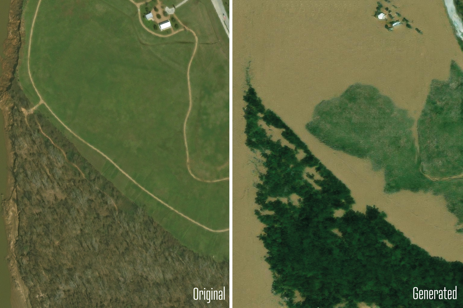
With help from AI, MIT scientists developed a method that generates satellite imagery from the future to depict how a region would look after a potential flooding event.
Bing
New AI tool generates realistic satellite images of future flooding
https://news.mit.edu/2024/new-ai-tool-generates-realistic-satellite-images-future-flooding-1125
With help from AI, MIT scientists developed a method that generates satellite imagery from the future to depict how a region would look after a potential flooding event.
DuckDuckGo
New AI tool generates realistic satellite images of future flooding
With help from AI, MIT scientists developed a method that generates satellite imagery from the future to depict how a region would look after a potential flooding event.
General Meta Tags
10- titleNew AI tool generates realistic satellite images of future flooding | MIT News | Massachusetts Institute of Technology
- charsetutf-8
- viewportwidth=device-width, initial-scale=1.0
- descriptionWith help from AI, MIT scientists developed a method that generates satellite imagery from the future to depict how a region would look after a potential flooding event.
- keywordsMIT EAPS, MIT AeroAstro, MIT Media Lab, Björn Lütjens, Dava Newman, Maxar, satellite imaging, generative AI, flood map, Science communication
Open Graph Meta Tags
7- og:titleNew AI tool generates realistic satellite images of future flooding
- og:imagehttps://news.mit.edu/sites/default/files/images/202411/MIT-AI-Flood-01-press.jpg
- og:descriptionWith help from AI, MIT scientists developed a method that generates satellite imagery from the future to depict how a region would look after a potential flooding event.
- og:site_nameMIT News | Massachusetts Institute of Technology
- og:typearticle
Twitter Meta Tags
2- twitter:site@mit
- twitter:cardsummary_large_image
Link Tags
10- apple-touch-icon/themes/mit/assets/img/favicon/apple-touch-icon.png
- canonicalhttps://news.mit.edu/2024/new-ai-tool-generates-realistic-satellite-images-future-flooding-1125
- icon/themes/mit/assets/img/favicon/favicon.ico
- icon/themes/mit/assets/img/favicon/favicon.svg
- image_srchttps://news.mit.edu/sites/default/files/images/202411/MIT-AI-Flood-01-press.jpg
Emails
1Links
108- http://calendar.mit.edu
- http://careers.mit.edu
- http://comms.mit.edu
- http://creativecommons.org/licenses/by-nc-nd/3.0
- http://socialmediahub.mit.edu